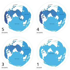
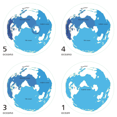
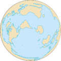
ملف:World ocean map.gif

من أرابيكا، الموسوعة الحرة
اذهب إلى التنقل اذهب إلى البحث

World_ocean_map.gif(500 × 500 بكسل حجم الملف: 68 كيلوبايت، نوع MIME: image/gif، ‏ملفوف، ‏4 إطارات، ‏10ث)

ملخص

الوصف
English: Animated map exhibiting the world's oceanic waters. A continuous body of water encircling Earth, the World Ocean is divided into a number of principal areas with relatively uninhibited interchange among them. Five oceanic divisions are usually defined: Pacific, Atlantic, Indian, Arctic, and Southern; the last two listed are sometimes consolidated into the first three.

Animated world ocean map (GIF), exhibiting various oceans. Azimuthal distance projection map is based on world map from this online Java tool by Henry Bottomley and altered using CorelDraw/PhotoPaint, et al. Map is centered on 85° W, 45° S, rotated 90° CCW (North Pole is to the left). Ocean boundaries per International Hydrographic Organisation.

  • blue: ocean
  • black: other substantial bodies of water (viz. Caspian Sea, Great Lakes)
  • white: land
  • green dotted line: map periphery
التاريخ
المصدر

Own work using:

المؤلف User:Quizimodo
الترخيص
(إعادة استخدام هذا الملف)
Public domain أنا، مالِك حقوق تأليف ونشر هذا العمل، أجعله في النِّطاق العامِّ، يسري هذا في أرجاء العالم كلِّه.
في بعض البلدان، قد يكون هذا التَّرخيص غيرَ مُمكنٍ قانونيَّاً، في هذه الحالة:
أمنح الجميع حق استخدام هذا العمل لأي غرض دون أي شرط ما لم يفرض القانون شروطًا إضافية.
إصدارات أخرى

الشروحات

أضف شرحاً من سطر واحد لما يُمثِّله هذا الملف

العناصر المصورة في هذا الملف

يُصوِّر

٨ أكتوبر 2007

تاريخ الملف

اضغط على زمن/تاريخ لرؤية الملف كما بدا في هذا الزمن.

زمن/تاريخصورة مصغرةالأبعادمستخدمتعليق
حالي08:12، 8 أبريل 2007تصغير للنسخة بتاريخ 08:12، 8 أبريل 2007500 × 500 (68 كيلوبايت)commonswiki>Quizatz HaderachAnimated world ocean map!

ال1 ملف التالي مكررات لهذا الملف (المزيد من التفاصيل):

الصفحتان التاليتان تستخدمان هذا الملف: