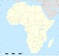
ملف:Africa land cover location map.jpg

من أرابيكا، الموسوعة الحرة
اذهب إلى التنقل اذهب إلى البحث

الملف الأصلي(1٬525 × 1٬440 بكسل حجم الملف: 523 كيلوبايت، نوع MIME: image/jpeg)

ملخص

الوصف
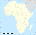
English: Simulated land cover map of Africa showing the natural aspect of the land with bathymetry as it could be seen from space; for geo-location purposes. Borders as in July 2011.
Français : Carte de la couverture du sol simulée de l'Afrique montrant l'aspect naturel des terres telles qu'elles seraient vues depuis l'espace, avec bathymétrie ; destinée à la géolocalisation. Frontières telles qu'en juillet 2011.

Lambert azimutal equal-area projection, WGS84 datum

  • Standard meridian: 15°E
  • Standard parallel: 0°
Scale: 1:23,420,000 (precision: 5,855 km)
التاريخ يوليو ٢٠١٠, updated 2011-07
المصدر

Blank background map: Natural Earth II (public domain) by Tom Patterson, US National Park Service

Re-projection and additional data by Sting
المؤلف Tom Patterson and Eric Gaba (Sting - fr:Sting)
الترخيص
(إعادة استخدام هذا الملف)
Public domain
إصدارات أخرى
موقع آلة التصوير٠° ٠٠′ ٠٠″ ش, ١٥° ٠٠′ ٠٠″ ق Kartographer map based on OpenStreetMap.هذه وغيرها من الصور في مواقعها على: خريطة الشارع المفتوحةinfo

ترخيص

Public domain This work was previously under Public Domain, or a Free License. It has been digitally enhanced and/or modified. This derivative work has been (or is hereby) released into the public domain by its author, Sting at the French Wikipedia project. This applies worldwide.

In some countries this is not legally possible; if so:
Sting grants anyone the right to use this work for any purpose, without any conditions, unless such conditions are required by law.


English  简体中文‎  繁體中文‎  +/−

الشروحات

أضف شرحاً من سطر واحد لما يُمثِّله هذا الملف

العناصر المصورة في هذا الملف

يُصوِّر

0°0'0.000"N, 15°0'0.000"E

٥٣٥٬٠٨٦ بايت

١٬٤٤٠ بكسل

١٬٥٢٥ بكسل

تاريخ الملف

اضغط على زمن/تاريخ لرؤية الملف كما بدا في هذا الزمن.

زمن/تاريخصورة مصغرةالأبعادمستخدمتعليق
حالي22:54، 14 يوليو 2011تصغير للنسخة بتاريخ 22:54، 14 يوليو 20111٬525 × 1٬440 (523 كيلوبايت)commonswiki>StingSudan/South Sudan 07-2011 border update

ال1 ملف التالي مكررات لهذا الملف (المزيد من التفاصيل):

الصفحة التالية تستخدم هذا الملف:

بيانات وصفية